


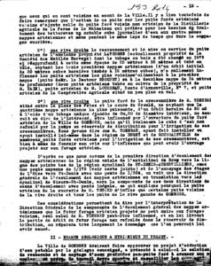
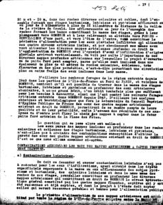
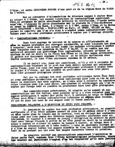
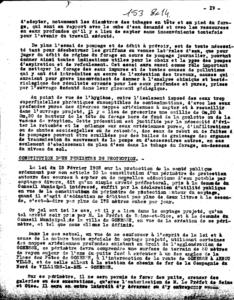
Identifiant national de l'ouvrage
BSS000LLHY
Ancien code - avant 2017
01538X0014
Localisation
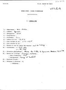
Département
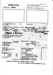
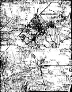
VAL D OISE (95) - SGR/IDFCommune
GONESSE (95277)Nom local
F1Numéro de carte
0153Huitičme
8XRégion naturelle
SOISSONNAISBassin versant
Non renseignéAdresse ou Lieu-dit
PLACE DES FETESCoordonnées
| Systčme | X (m) | Y (m) |
|---|---|---|
| Lambert 2 étendu | 607645 | 2442944 |
| Lambert 1 - Nord | 607640 | 142700 |
| Lambert-93 | 659079 | 6876220 |
| Systčme | Latitude | Longitude |
|---|---|---|
| WGS84 | 48.98460681 | 48° 59' 4'' N | 2.44089131 | 2° 26' 27'' E |
Altitude
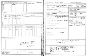
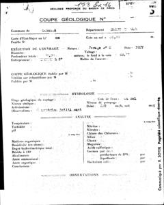
47.35 m - Précision C10Description technique
Nature
FORAGEProfondeur atteinte
60.0 mDiamčtre de l'ouvrage
Non renseignéDate fin de travaux
1926-01-01 00:00:00.0Mode d'exécution
BATTAGE.Etat de l'ouvrage
JAILLISSANT.Utilisation
EAU-COLLECTIVEObjet de la recherche
Non renseignéObjet de l'exploitation
EAU.Objet de la reconnaissance
Non renseignéGisement
Non renseignéRéférences
Non renseignéRéférencé comme point d'eau
 OUI
OUI
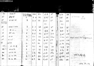
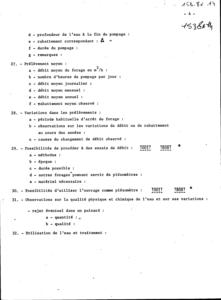
Niveau d'eau mesuré par rapport au sol
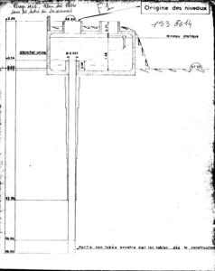
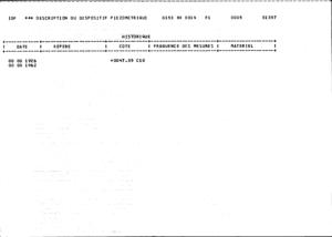
1.52 m - 1926-01-01 00:00:00.0Coupe
Z Origine
47.35 - Précision : C10Auteur
Non renseignéDate
Non renseignéDocument(s) numérisé(s)
37 document(s)| Vignette | Nom | Type | Poids |
|---|---|---|---|
|
R17251.TIF |
|
66 Ko |
|
R17252.TIF |
|
67 Ko |
|
R17254.TIF |
|
42 Ko |
|
R17255.TIF |
|
49 Ko |
|
R17256.TIF |
|
17 Ko |
|
R17257.TIF |
|
26 Ko |

|
R17258.TIF |
|
25 Ko |
|
R17259.TIF |
|
24 Ko |
|
R17260.TIF |
|
26 Ko |
|
R17263.TIF |
|
15 Ko |
|
R17265.TIF |
|
62 Ko |
|
R17268.TIF |
|
53 Ko |
|
R17269.TIF |
|
149 Ko |
|
R17270.TIF |
|
52 Ko |
|
R17271.TIF |
|
89 Ko |
|
R17272.TIF |
|
68 Ko |
|
R17273.TIF |
|
140 Ko |
|
R17274.TIF |
|
150 Ko |
|
R17275.TIF |
|
153 Ko |
|
R17276.TIF |
|
173 Ko |
|
R17277.TIF |
|
116 Ko |
|
R17278.TIF |
|
127 Ko |
|
R17279.TIF |
|
151 Ko |
|
R17280.TIF |
|
172 Ko |
|
R17281.TIF |
|
164 Ko |
|
R17282.TIF |
|
150 Ko |
|
R17283.TIF |
|
129 Ko |
|
R17284.TIF |
|
121 Ko |
|
R17285.TIF |
|
164 Ko |
|
R17286.TIF |
|
172 Ko |
|
R17287.TIF |
|
175 Ko |
|
R17288.TIF |
|
162 Ko |
|
R17289.TIF |
|
171 Ko |
|
R17290.TIF |
|
59 Ko |
|
R17291.TIF |
|
149 Ko |
|
R17292.TIF |
|
170 Ko |
|
R17293.TIF |
|
133 Ko |
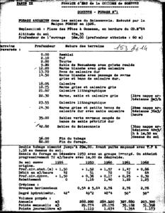
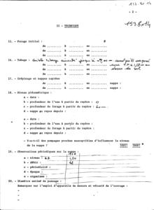
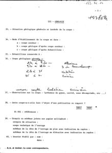
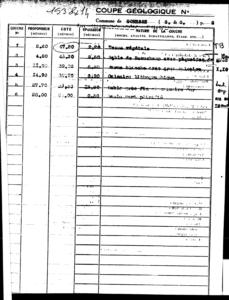
Log géologique numérisé
Nombre de passes :
16 - Afficher le log validéNombre de niveaux :
4| Profondeur | Lithologie | Stratigraphie |
|---|---|---|
| De 0 ŕ 9,2 m | SUPERF, SABLE, TOURBE | QUATERNAIRE |
| De 9,2 ŕ 12,2 m | SABLE, GALET, MARNE, SABLES DE BEAUCHAMP | AUVERSIEN |
| De 12,2 ŕ 42,8 m | MARNE, CALCAIRE, MARNES ET CAILLASSES ET CALCAIRE GROSSIER | EOCENE-MOYEN |
| De 42,8 ŕ 60 m | SABLE, SABLE DE CUISE | CUISIEN |