


Identifiant national de l'ouvrage
BSS000RQVP
Ancien code - avant 2017
02205X0120
Localisation
Département
SEINE ET MARNE (77) - SGR/IDFCommune
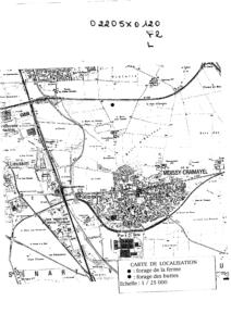
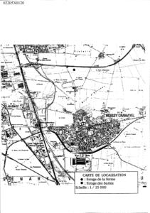
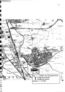
MOISSY CRAMAYEL (77296)Nom local
F2Numéro de carte
0220Huitičme
5XRégion naturelle
BRIEBassin versant
Non renseignéAdresse ou Lieu-dit
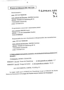
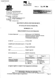
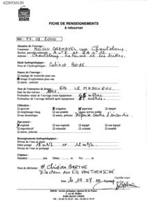
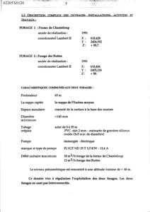
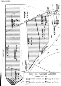
FERME DE CHANTELOUP, FORAGE DES BUTTESCoordonnées
| Systčme | X (m) | Y (m) |
|---|---|---|
| Lambert 2 étendu | 618403 | 2405235 |
| Lambert 1 - Nord | 618396 | 105013 |
| Lambert-93 | 669513 | 6838446 |
| Systčme | Latitude | Longitude |
|---|---|---|
| WGS84 | 48.64547338 | 48° 38' 43'' N | 2.58615182 | 2° 35' 10'' E |
Altitude
88.0 m - Précision IGNDescription technique
Nature
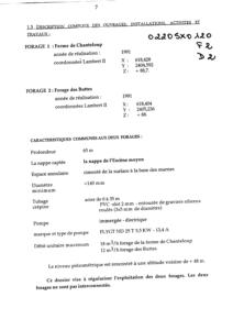
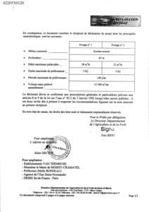
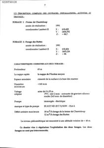
FORAGEProfondeur atteinte
65.0 mDiamčtre de l'ouvrage
140 mmDate fin de travaux
1991-12-30 00:00:00.0Mode d'exécution
ROTATION.Etat de l'ouvrage
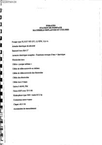
POMPE, CREPINE.Utilisation
EAU-ASPERSION.Objet de la recherche
Non renseignéObjet de l'exploitation
EAU.Objet de la reconnaissance
Non renseignéGisement
Non renseignéRéférences
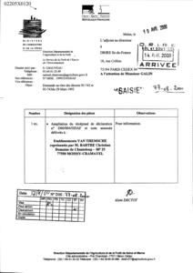
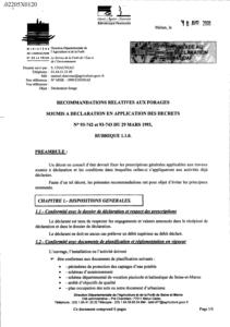
DECLARATION CODE MINIER 77-08-2000Référencé comme point d'eau
 OUI
OUI
Niveau d'eau mesuré par rapport au sol
45.0 m -Coupe
Z Origine
Non renseignéAuteur
Non renseignéDate
Non renseignéDocument(s) numérisé(s)
39 document(s)| Vignette | Nom | Type | Poids |
|---|---|---|---|
|
A127873.TIF |
|
30 Ko |
|
A127874.TIF |
|
27 Ko |
|
A127875.TIF |
|
35 Ko |
|
A127876.TIF |
|
92 Ko |
|
R132089.TIF |
|
37 Ko |
|
R132090.TIF |
|
56 Ko |
|
R132091.TIF |
|
51 Ko |
|
R132092.TIF |
|
67 Ko |
|
R132093.TIF |
|
76 Ko |
|
R132094.TIF |
|
82 Ko |
|
R132095.TIF |
|
74 Ko |
|
R132096.TIF |
|
61 Ko |
|
R132097.TIF |
|
50 Ko |
|
R132098.TIF |
|
40 Ko |
|
R132099.TIF |
|
29 Ko |
|
R132100.TIF |
|
98 Ko |
|
R132101.TIF |
|
33 Ko |
|
R132102.TIF |
|
22 Ko |
|
R132103.TIF |
|
29 Ko |
|
R132104.TIF |
|
26 Ko |
|
R132105.TIF |
|
30 Ko |
|
R132106.TIF |
|
27 Ko |
|
R132107.TIF |
|
27 Ko |
|
R132108.TIF |
|
16 Ko |
|
R132109.TIF |
|
68 Ko |
|
R132110.TIF |
|
46 Ko |
|
R132111.TIF |
|
31 Ko |
|
R132112.TIF |
|
96 Ko |
|
R132113.TIF |
|
92 Ko |
|
R132114.TIF |
|
46 Ko |
|
R132115.TIF |
|
40 Ko |
|
R132116.TIF |
|
92 Ko |
|
R132117.TIF |
|
35 Ko |
|
R132118.TIF |
|
28 Ko |
|
R132119.TIF |
|
104 Ko |
|
R132120.TIF |
|
18 Ko |
|
R132121.TIF |
|
42 Ko |
|
R132122.TIF |
|
58 Ko |
|
R132123.TIF |
|
18 Ko |
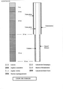
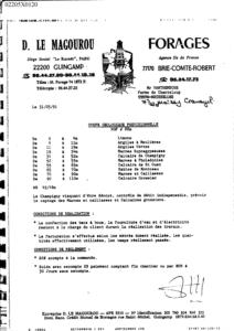
Log géologique numérisé
Nombre de niveaux :
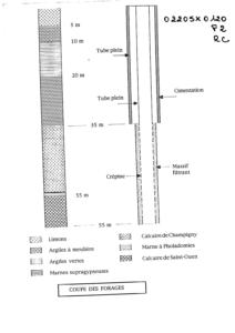
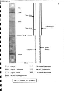
7| Profondeur | Lithologie | Stratigraphie |
|---|---|---|
| De 0 ŕ 5 m | LIMONS | QUATERNAIRE |
| De 5 ŕ 10 m | ARGILES A MEULIERE | STAMPIEN |
| De 10 ŕ 20 m | ARGILES VERTES | STAMPIEN |
| De 20 ŕ 35 m | MARNES SUPRAGYPSEUSES | LUDIEN |
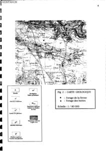
| De 35 ŕ 55 m | CALCAIRE DE CHAMPIGNY | LUDIEN |
| De 55 ŕ 56 m | MARNES A PHOLADOMIES | LUDIEN |
| De 56 ŕ 65 m | CALCAIRE DE SAINT OUEN | MARINESIEN |