


Identifiant national de l'ouvrage
BSS000VGNC
Ancien code - avant 2017
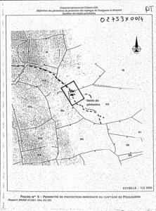
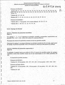
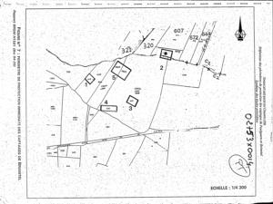
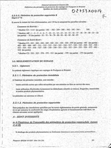
02753X0014
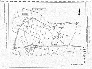
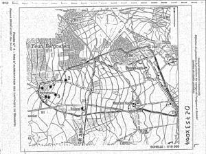
Localisation
Département
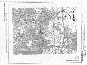
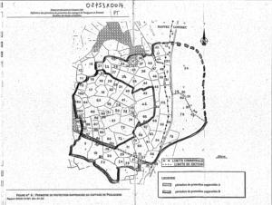
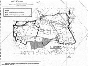
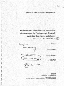
FINISTERE (29) - SGR/BRECommune
HANVEC (29078)Nom local
P2Numéro de carte
0275Huitičme
3XRégion naturelle
MASSIF-ARMORICAIN-NORDBassin versant
Non renseignéAdresse ou Lieu-dit
BRIANTELCoordonnées
| Systčme | X (m) | Y (m) |
|---|---|---|
| Lambert 2 étendu | 123971 | 2392178 |
| Lambert 1 - Nord | 124100 | 92800 |
| Lambert-93 | 175322 | 6829460 |
| Systčme | Latitude | Longitude |
|---|---|---|
| WGS84 | 48.35321585 | 48° 21' 11'' N | -4.09189817 | 4° 5' 30'' O |
Altitude
172.0 m - Précision EPDDescription technique
Nature
PUITSProfondeur atteinte
Non renseignéDiamčtre de l'ouvrage
Non renseignéDate fin de travaux
Non renseignéMode d'exécution
Non renseignéEtat de l'ouvrage
EXPLOITE.Utilisation
EAU-COLLECTIVEObjet de la recherche
Non renseignéObjet de l'exploitation
EAU.Objet de la reconnaissance
Non renseignéGisement
Non renseignéRéférences
-Référencé comme point d'eau
 OUI
OUI
Niveau d'eau mesuré par rapport au sol
Non renseignéCoupe
Z Origine
175.0 - Précision :Auteur
Non renseignéDate
Non renseignéDocument(s) numérisé(s)
28 document(s)| Vignette | Nom | Type | Poids |
|---|---|---|---|
|
G0350477.TIF |
|
151 Ko |
|
G0350478.TIF |
|
154 Ko |
|
G0350479.TIF |
|
145 Ko |
|
G0350480.TIF |
|
148 Ko |
|
G0350481.TIF |
|
183 Ko |
|
G0350482.TIF |
|
155 Ko |
|
G0350483.TIF |
|
153 Ko |
|
G0350484.TIF |
|
202 Ko |
|
G0350485.TIF |
|
155 Ko |
|
G0350486.TIF |
|
140 Ko |
|
G0350487.TIF |
|
163 Ko |
|
G0350488.TIF |
|
171 Ko |
|
G0350489.TIF |
|
157 Ko |
|
G0350490.TIF |
|
156 Ko |
|
G0350491.TIF |
|
156 Ko |
|
G0350492.TIF |
|
155 Ko |
|
G0350493.TIF |
|
160 Ko |
|
G0350494.TIF |
|
102 Ko |
|
G0350495.TIF |
|
101 Ko |
|
G0350496.TIF |
|
144 Ko |
|
G0350497.TIF |
|
152 Ko |
|
G0350498.TIF |
|
154 Ko |
|
G0350499.TIF |
|
146 Ko |
|
G0350500.TIF |
|
146 Ko |
|
G0350501.TIF |
|
241 Ko |
|
G0350502.TIF |
|
255 Ko |
|
G0350503.TIF |
|
140 Ko |
|
G0350504.TIF |
|
16 Ko |