


Identifiant national de l'ouvrage
BSS000YYNA
Ancien code - avant 2017
03426X0266
Localisation
Département
HAUT RHIN (68) - SGR/ALSCommune
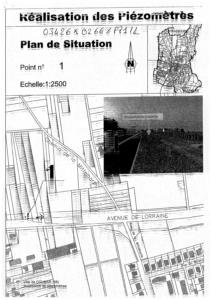
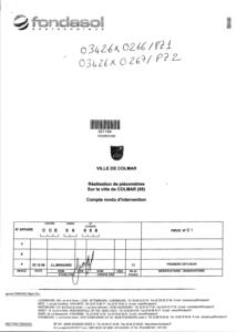
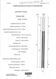
COLMAR (68066)Nom local
PZ1Numéro de carte
0342Huitičme
6XRégion naturelle
VALLEE-DU-RHINBassin versant
Non renseignéAdresse ou Lieu-dit
OBERHARDTCoordonnées
| Systčme | X (m) | Y (m) |
|---|---|---|
| Lambert 2 étendu | 972464 | 2355501 |
| Lambert 2 - Centre | 972464 | 355502 |
| Lambert-93 | 1022891 | 6785722 |
| Systčme | Latitude | Longitude |
|---|---|---|
| WGS84 | 48.092023 | 48° 5' 31'' N | 7.339218 | 7° 20' 21'' E |
Altitude
200.0 m - PrécisionDescription technique
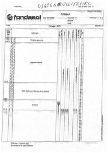
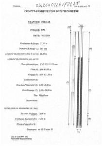
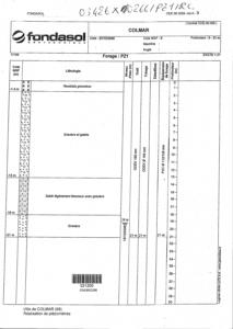
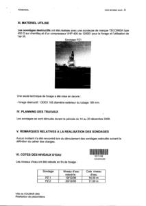
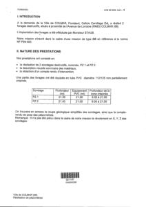
Nature
FORAGEProfondeur atteinte
21.0 mDiamčtre de l'ouvrage
165 mmDate fin de travaux
2006-12-20 00:00:00.0Mode d'exécution
AIR.Etat de l'ouvrage
MESURE, ACCES, PRELEV, CREPINE.Utilisation
PIEZOMETRE.Objet de la recherche
Non renseignéObjet de l'exploitation
Non renseignéObjet de la reconnaissance
POLLUTION-NAPPE.Gisement
Non renseignéRéférences
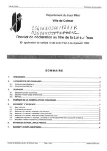
DOSSIER DECLARATION LOI SUR L EAURéférencé comme point d'eau
 OUI
OUI
Niveau d'eau mesuré par rapport au sol
19.0 m - 2006-12-19 00:00:00.0Coupe
Z Origine
200.0 - Précision :Auteur
FONDASOLDate
Non renseignéDocument(s) numérisé(s)
21 document(s)| Vignette | Nom | Type | Poids |
|---|---|---|---|
|
B62993.TIF |
|
99 Ko |
|
B62994.TIF |
|
329 Ko |
|
B62995.TIF |
|
144 Ko |
|
B62996.TIF |
|
143 Ko |
|
T366145.TIF |
|
72 Ko |
|
T366146.TIF |
|
8 Ko |
|
T366147.TIF |
|
60 Ko |
|
T366148.TIF |
|
28 Ko |
|
T366149.TIF |
|
12 Ko |
|
T366150.TIF |
|
35 Ko |
|
T366151.TIF |
|
49 Ko |
|
T366152.TIF |
|
100 Ko |
|
T366153.TIF |
|
63 Ko |
|
T366154.TIF |
|
205 Ko |
|
T366155.TIF |
|
88 Ko |
|
T366156.TIF |
|
201 Ko |
|
T366157.TIF |
|
174 Ko |
|
T366158.TIF |
|
118 Ko |
|
T366159.TIF |
|
286 Ko |
|
T366160.TIF |
|
86 Ko |
|
T366161.TIF |
|
80 Ko |