


Identifiant national de l'ouvrage
BSS000ZCML
Ancien code - avant 2017
03453X0018
Localisation
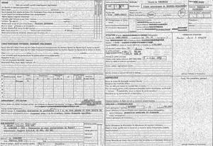
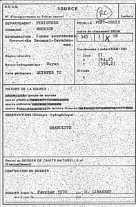
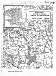
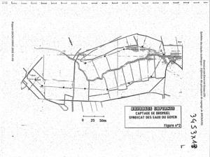
Département
FINISTERE (29) - SGR/BRECommune
PLOUHINEC (29197)Nom local
HYNuméro de carte
0345Huitičme
3XRégion naturelle
MASSIF-ARMORICAIN-NORDBassin versant
Non renseignéAdresse ou Lieu-dit
BROMUELCoordonnées
| Systčme | X (m) | Y (m) |
|---|---|---|
| Lambert 2 étendu | 93900 | 2358250 |
| Lambert 2 - Centre | 93900 | 358250 |
| Lambert-93 | 145002 | 6795796 |
| Systčme | Latitude | Longitude |
|---|---|---|
| WGS84 | 48.02650033 | 48° 1' 35'' N | -4.45651355 | 4° 27' 23'' O |
Altitude
60.0 m - Précision EPDDescription technique
Nature
PUITSProfondeur atteinte
4.0 mDiamčtre de l'ouvrage
Non renseignéDate fin de travaux
Non renseignéMode d'exécution
Non renseignéEtat de l'ouvrage
AMENAGE, EXPLOITE.Utilisation
EAU-COLLECTIVEObjet de la recherche
Non renseignéObjet de l'exploitation
EAU.Objet de la reconnaissance
Non renseignéGisement
Non renseignéRéférences
-Référencé comme point d'eau
 OUI
OUI
Niveau d'eau mesuré par rapport au sol
Non renseignéCoupe
Z Origine
Non renseignéAuteur
Non renseignéDate
Non renseignéDocument(s) numérisé(s)
35 document(s)| Vignette | Nom | Type | Poids |
|---|---|---|---|
|
G0360427.TIF |
|
441 Ko |
|
G0360428.TIF |
|
91 Ko |
|
G0360429.TIF |
|
83 Ko |
|
G0360430.TIF |
|
96 Ko |
|
G0360431.TIF |
|
101 Ko |
|
G0360432.TIF |
|
102 Ko |
|
G0360433.TIF |
|
160 Ko |
|
G0360434.TIF |
|
120 Ko |
|
G0360435.TIF |
|
86 Ko |
|
G0360436.TIF |
|
110 Ko |
|
G0360437.TIF |
|
106 Ko |
|
G0360438.TIF |
|
113 Ko |
|
G0360439.TIF |
|
97 Ko |
|
G0360440.TIF |
|
157 Ko |
|
G0360441.TIF |
|
106 Ko |
|
G0360442.TIF |
|
126 Ko |
|
G0360443.TIF |
|
107 Ko |
|
G0360444.TIF |
|
93 Ko |
|
G0360445.TIF |
|
89 Ko |
|
G0360446.TIF |
|
109 Ko |
|
G0360447.TIF |
|
102 Ko |
|
G0360448.TIF |
|
104 Ko |
|
G0360449.TIF |
|
101 Ko |
|
G0360450.TIF |
|
101 Ko |
|
G0360451.TIF |
|
105 Ko |
|
G0360452.TIF |
|
130 Ko |
|
G0360453.TIF |
|
86 Ko |
|
G0360454.TIF |
|
161 Ko |
|
G0360455.TIF |
|
451 Ko |
|
G0360456.TIF |
|
121 Ko |
|
G0360457.TIF |
|
95 Ko |
|
G0360458.TIF |
|
98 Ko |
|
G0360459.TIF |
|
107 Ko |
|
G0360460.TIF |
|
107 Ko |
|
G0360461.TIF |
|
102 Ko |