


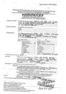
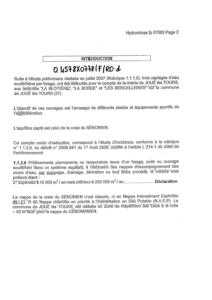
Identifiant national de l'ouvrage
BSS001FJUD
Ancien code - avant 2017
04578X0778
Localisation
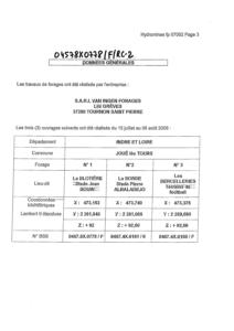
Département
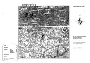
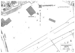
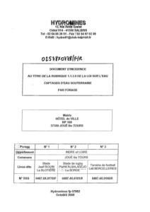
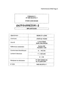
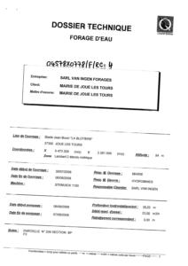
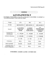
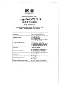
INDRE ET LOIRE (37) - SGR/CENCommune
JOUE LES TOURS (37122)Nom local
FNuméro de carte
0457Huitičme
8XRégion naturelle
ANJOU-TOURAINEBassin versant
Non renseignéAdresse ou Lieu-dit
STADE JEAN BOUIN - LA BLOTIERE PARCELLE BD-209Coordonnées
| Systčme | X (m) | Y (m) |
|---|---|---|
| Lambert 2 étendu | 473153 | 2261640 |
| Lambert 2 - Centre | 473153 | 261640 |
| Lambert-93 | 523172 | 6696171 |
| Systčme | Latitude | Longitude |
|---|---|---|
| WGS84 | 47.3422623 | 47° 20' 32'' N | 0.65771988 | 0° 39' 27'' E |
Altitude
92.0 m - Précision EPDDescription technique
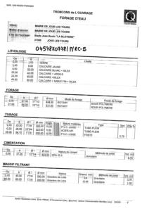
Nature
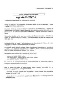
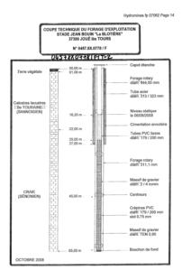
FORAGEProfondeur atteinte
64.0 mDiamčtre de l'ouvrage
179 mmDate fin de travaux
2008-08-07 00:00:00.0Mode d'exécution
BOUE,ROTATION.Etat de l'ouvrage
CIMENTATION-ANNULAIRE, TUBE-PLASTIQUE, EXPLOITE, MESURE.Utilisation
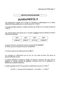
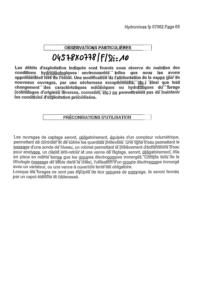
EAU-ASPERSION,EAU-SERVICE-PUBLIC.Objet de la recherche
Non renseignéObjet de l'exploitation
EAU.Objet de la reconnaissance
Non renseignéGisement
Non renseignéRéférences
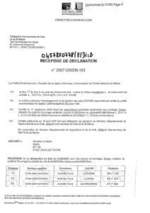
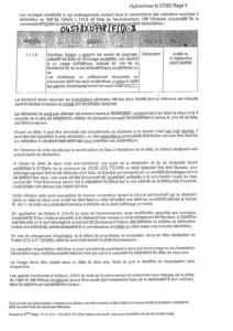
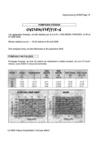
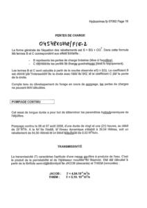
HYDROMINES FP 07062 (OCTOBRE 2008)Référencé comme point d'eau
 OUI
OUI
Niveau d'eau mesuré par rapport au sol
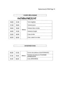
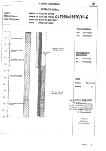
Non renseignéCoupe
Z Origine
92.0 - Précision : M01Auteur
FOREURDate
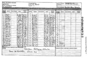
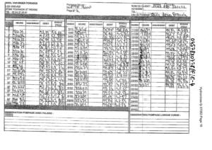
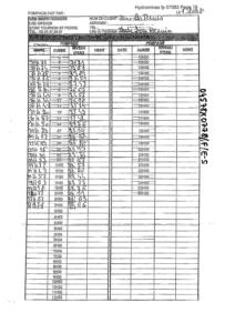
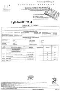
2008-08-07 00:00:00.0Document(s) numérisé(s)
32 document(s)| Vignette | Nom | Type | Poids |
|---|---|---|---|
|
B127438.TIF |
|
312 Ko |
|
B127495.TIF |
|
67 Ko |
|
B127496.TIF |
|
103 Ko |
|
B127497.TIF |
|
34 Ko |
|
B127498.TIF |
|
44 Ko |
|
B127499.TIF |
|
32 Ko |
|
B127500.TIF |
|
56 Ko |
|
B127501.TIF |
|
115 Ko |
|
B127502.TIF |
|
28 Ko |
|
B127503.TIF |
|
26 Ko |
|
B127504.TIF |
|
40 Ko |
|
B127505.TIF |
|
23 Ko |
|
B127506.TIF |
|
59 Ko |
|
B127507.TIF |
|
116 Ko |
|
B127508.TIF |
|
366 Ko |
|
B127509.TIF |
|
46 Ko |
|
B127510.TIF |
|
156 Ko |
|
B127511.TIF |
|
191 Ko |
|
B127512.TIF |
|
112 Ko |
|
B127513.TIF |
|
75 Ko |
|
B127514.TIF |
|
31 Ko |
|
B127515.TIF |
|
453 Ko |
|
B127516.TIF |
|
42 Ko |
|
B127517.TIF |
|
45 Ko |
|
B127518.TIF |
|
51 Ko |
|
B127519.TIF |
|
38 Ko |
|
B127520.TIF |
|
60 Ko |
|
B127521.TIF |
|
57 Ko |
|
B127522.TIF |
|
34 Ko |
|
B141575.TIF |
|
66 Ko |
|
B141576.TIF |
|
55 Ko |
|
B141577.TIF |
|
32 Ko |