


Identifiant national de l'ouvrage
BSS001HNHC
Ancien code - avant 2017
04873X0053
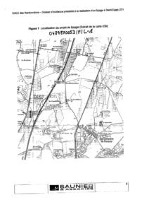
Localisation
Département
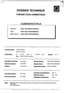
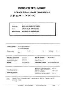
INDRE ET LOIRE (37) - SGR/CENCommune
SAVONNIERES (37243)Nom local
FNuméro de carte
0487Huitičme
3XRégion naturelle
ANJOU-TOURAINEBassin versant
Non renseignéAdresse ou Lieu-dit
10 ROUTE DE LOUCHERIE PARCELLE AN-44PCoordonnées
| Systčme | X (m) | Y (m) |
|---|---|---|
| Lambert 2 étendu | 465520 | 2261085 |
| Lambert 2 - Centre | 465520 | 261085 |
| Lambert-93 | 515541 | 6695680 |
| Systčme | Latitude | Longitude |
|---|---|---|
| WGS84 | 47.33576005 | 47° 20' 8'' N | 0.55689787 | 0° 33' 24'' E |
Altitude
92.5 m - Précision EPDDescription technique
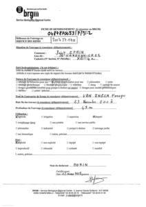
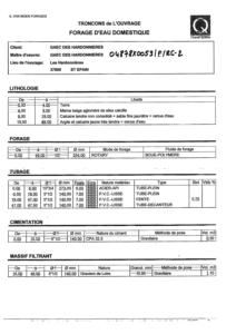
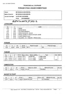
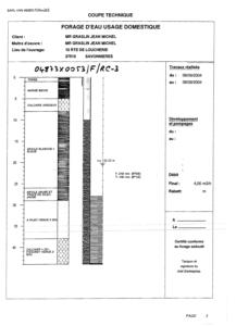
Nature
FORAGEProfondeur atteinte
44.0 mDiamčtre de l'ouvrage
126 mmDate fin de travaux
2004-09-08 00:00:00.0Mode d'exécution
MARTEAU-FOND,AIR.Etat de l'ouvrage
TUBE-PLASTIQUE, MESURE, EXPLOITE.Utilisation
EAU-DOMESTIQUE,EAU-ASPERSION.Objet de la recherche
Non renseignéObjet de l'exploitation
EAU.Objet de la reconnaissance
Non renseignéGisement
Non renseignéRéférences
Non renseignéRéférencé comme point d'eau
 OUI
OUI
Niveau d'eau mesuré par rapport au sol
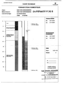
20.23 m - 2004-09-08 00:00:00.0Coupe
Z Origine
92.5 - Précision : M01Auteur
FOREURDate
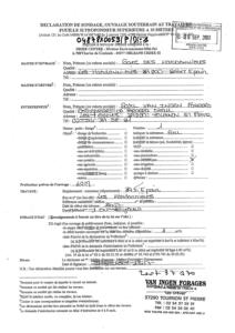
2004-09-08 00:00:00.0Document(s) numérisé(s)
20 document(s)| Vignette | Nom | Type | Poids |
|---|---|---|---|
|
B139517.TIF |
|
22 Ko |
|
B139518.TIF |
|
41 Ko |
|
B139519.TIF |
|
45 Ko |
|
B139520.TIF |
|
82 Ko |
|
B139521.TIF |
|
37 Ko |
|
B139522.TIF |
|
57 Ko |
|
B139523.TIF |
|
71 Ko |
|
B139524.TIF |
|
63 Ko |
|
B139525.TIF |
|
47 Ko |
|
B139526.TIF |
|
38 Ko |
|
B139527.TIF |
|
50 Ko |
|
B139528.TIF |
|
36 Ko |
|
B139529.TIF |
|
50 Ko |
|
B139530.TIF |
|
84 Ko |
|
B139531.TIF |
|
79 Ko |
|
B139532.TIF |
|
61 Ko |
|
B139533.TIF |
|
47 Ko |
|
B28075.TIF |
|
33 Ko |
|
B28076.TIF |
|
50 Ko |
|
B28077.TIF |
|
58 Ko |