


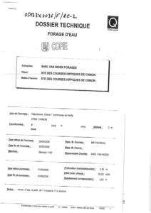
Identifiant national de l'ouvrage
BSS001KBHH
Ancien code - avant 2017
05133X0036
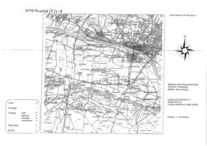
Localisation
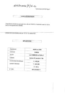
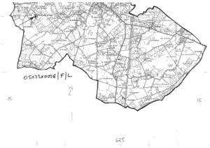
Département
INDRE ET LOIRE (37) - SGR/CENCommune
CHINON (37072)Nom local
FNuméro de carte
0513Huitičme
3XRégion naturelle
ANJOU-TOURAINEBassin versant
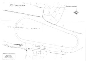
Non renseignéAdresse ou Lieu-dit
LES COMMUNS DE PARILLY (GRIGNY) PARCELLE BY-36ACoordonnées
| Systčme | X (m) | Y (m) |
|---|---|---|
| Lambert 2 étendu | 439340 | 2241595 |
| Lambert 2 - Centre | 439340 | 241595 |
| Lambert-93 | 489221 | 6676422 |
| Systčme | Latitude | Longitude |
|---|---|---|
| WGS84 | 47.15464829 | 47° 9' 16'' N | 0.21755608 | 0° 13' 3'' E |
Altitude
32.0 m - Précision EPDDescription technique
Nature
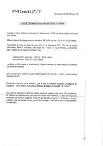
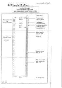
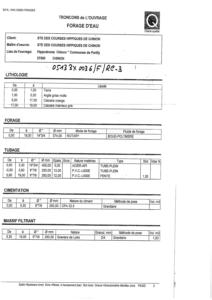
FORAGEProfondeur atteinte
19.0 mDiamčtre de l'ouvrage
226 mmDate fin de travaux
2006-06-01 00:00:00.0Mode d'exécution
BOUE,ROTATION.Etat de l'ouvrage
TUBE-PLASTIQUE, MESURE, EXPLOITE.Utilisation
EAU-ASPERSION.Objet de la recherche
Non renseignéObjet de l'exploitation
EAU.Objet de la reconnaissance
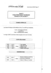
Non renseignéGisement
Non renseignéRéférences
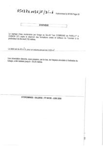
HYDROMINES = RAPPORT D'ETUDE D'INCIDENCE N° FP 06159 (JUIN 2006)Référencé comme point d'eau
 OUI
OUI
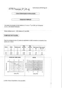
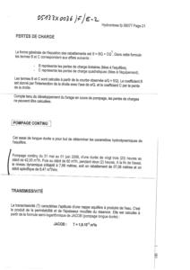
Niveau d'eau mesuré par rapport au sol
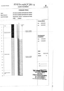
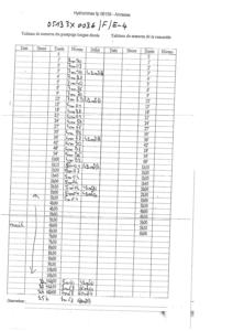
0.6 m - 2006-05-31 00:00:00.0Coupe
Z Origine
32.0 - Précision : M01Auteur
FOREURDate
2006-05-30 00:00:00.0Document(s) numérisé(s)
20 document(s)| Vignette | Nom | Type | Poids |
|---|---|---|---|
|
B47963.TIF |
|
36 Ko |
|
B47964.TIF |
|
34 Ko |
|
B47965.TIF |
|
39 Ko |
|
B47966.TIF |
|
42 Ko |
|
B47967.TIF |
|
56 Ko |
|
B47968.TIF |
|
52 Ko |
|
B47969.TIF |
|
103 Ko |
|
B47970.TIF |
|
67 Ko |
|
B47971.TIF |
|
98 Ko |
|
B47972.TIF |
|
91 Ko |
|
B47973.TIF |
|
97 Ko |
|
B47974.TIF |
|
59 Ko |
|
B47975.TIF |
|
79 Ko |
|
B47976.TIF |
|
359 Ko |
|
B47977.TIF |
|
30 Ko |
|
B47978.TIF |
|
58 Ko |
|
B47979.TIF |
|
85 Ko |
|
B47980.TIF |
|
411 Ko |
|
B47981.TIF |
|
71 Ko |
|
B48530.TIF |
|
142 Ko |