


Identifiant national de l'ouvrage
BSS001LLYU
Ancien code - avant 2017
05421X0014
Localisation
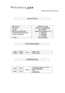
Département
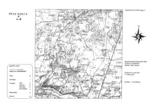
INDRE ET LOIRE (37) - SGR/CENCommune
NEUILLY LE BRIGNON (37168)Nom local
FNuméro de carte
0542Huitičme
1XRégion naturelle
ANJOU-TOURAINEBassin versant
Non renseignéAdresse ou Lieu-dit
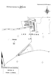
LES PLACES - SAINT SATURNIN PARCELLE ZL-63Coordonnées
| Systčme | X (m) | Y (m) |
|---|---|---|
| Lambert 2 étendu | 482725 | 2219520 |
| Lambert 2 - Centre | 482725 | 219520 |
| Lambert-93 | 532386 | 6654006 |
| Systčme | Latitude | Longitude |
|---|---|---|
| WGS84 | 46.96520419 | 46° 57' 54'' N | 0.79530481 | 0° 47' 43'' E |
Altitude
100.0 m - Précision EPDDescription technique
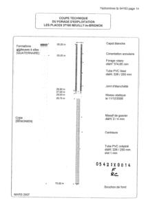
Nature
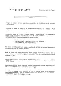
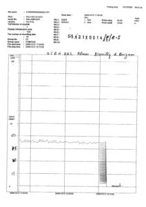
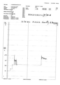
FORAGEProfondeur atteinte
70.0 mDiamčtre de l'ouvrage
226 mmDate fin de travaux
2006-12-12 00:00:00.0Mode d'exécution
ROTATION,BOUE,AIR.Etat de l'ouvrage
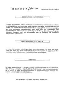
PRELEV, EXPLOITE, MESURE, TUBE-PLASTIQUE.Utilisation
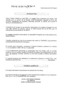
EAU-AGRICOLE,EAU-IRRIGATION.Objet de la recherche
Non renseignéObjet de l'exploitation
EAU.Objet de la reconnaissance
Non renseignéGisement
Non renseignéRéférences
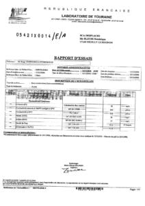
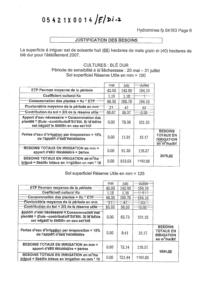
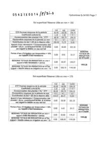
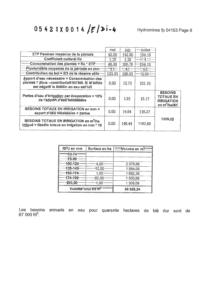
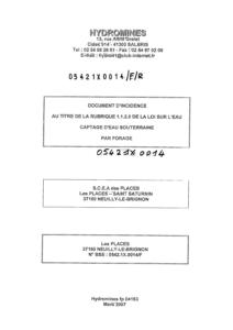
HYDROMINES = DOCUMENT D'INCIDENCE ET RAPPORT DES TRAVAUX N° FP 04163 (MARS 2007)Référencé comme point d'eau
 OUI
OUI
Niveau d'eau mesuré par rapport au sol
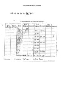
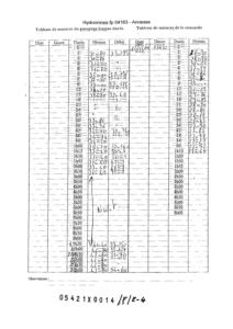
26.9 m - 2006-12-11 00:00:00.0Coupe
Z Origine
100.0 - Précision : M01Auteur
HYDROMINESDate
2007-03-31 00:00:00.0Document(s) numérisé(s)
26 document(s)| Vignette | Nom | Type | Poids |
|---|---|---|---|
|
B69698.TIF |
|
75 Ko |
|
B69699.TIF |
|
30 Ko |
|
B69700.TIF |
|
44 Ko |
|
B69701.TIF |
|
48 Ko |
|
B69702.TIF |
|
40 Ko |
|
B69703.TIF |
|
48 Ko |
|
B69704.TIF |
|
37 Ko |
|
B69705.TIF |
|
46 Ko |
|
B69706.TIF |
|
49 Ko |
|
B69707.TIF |
|
38 Ko |
|
B69708.TIF |
|
66 Ko |
|
B69709.TIF |
|
28 Ko |
|
B69710.TIF |
|
28 Ko |
|
B69711.TIF |
|
64 Ko |
|
B69712.TIF |
|
52 Ko |
|
B69713.TIF |
|
59 Ko |
|
B69714.TIF |
|
29 Ko |
|
B69715.TIF |
|
69 Ko |
|
B69716.TIF |
|
57 Ko |
|
B69717.TIF |
|
43 Ko |
|
B69718.TIF |
|
58 Ko |
|
B69719.TIF |
|
58 Ko |
|
B69720.TIF |
|
42 Ko |
|
B69721.TIF |
|
31 Ko |
|
B69722.TIF |
|
60 Ko |
|
B69723.TIF |
|
293 Ko |