


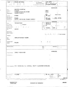
Identifiant national de l'ouvrage
BSS002APEN
Ancien code - avant 2017
08621X4001
Localisation
Département
LOZERE (48) - SGR/LROCommune
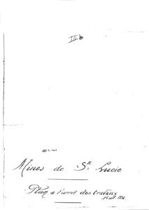
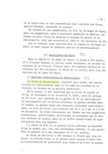
SAINT LEGER DE PEYRE (48168)Nom local
GTNuméro de carte
0862Huitičme
1XRégion naturelle
Non renseignéBassin versant
Non renseignéAdresse ou Lieu-dit
SAINTE-LUCIECoordonnées
| Systčme | X (m) | Y (m) |
|---|---|---|
| Lambert 2 étendu | 675351 | 1957122 |
| Lambert 3 - Sud | 675300 | 257200 |
| Lambert-93 | 722635 | 6390242 |
| Systčme | Latitude | Longitude |
|---|---|---|
| WGS84 | 44.61090729 | 44° 36' 39'' N | 3.28527111 | 3° 17' 6'' E |
Altitude
820.0 m - Précision EPDDescription technique
Nature
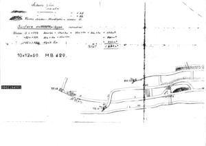
GITE-MINIERProfondeur atteinte
100.0 mDiamčtre de l'ouvrage
Non renseignéDate fin de travaux
1936-06-01 00:00:00.0Mode d'exécution
PUITS,TRACAGE.Etat de l'ouvrage
ANCIENNE-EXPLOITATION, INACCES.Utilisation
Non renseignéObjet de la recherche
Non renseignéObjet de l'exploitation
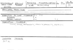
PLOMB,ARGENT.Objet de la reconnaissance
Non renseignéGisement
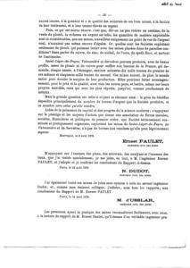
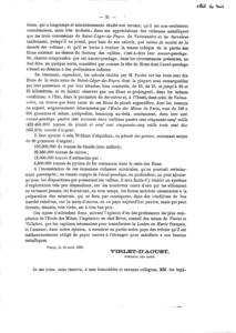
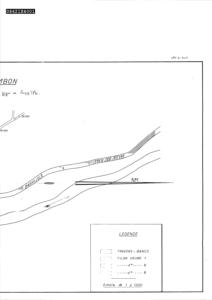
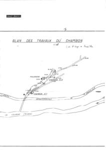
FILON.Références
GEFFROY.J (1951) B.S.G.F.,T.1,PP.389/409 - MARUEJOL.P (1956) THESE,CLERMONT-FERRAND - FICHE BRGM SGN/GMX,MISE A JOUR DE JP.PROUHET EN 1962Référencé comme point d'eau
 NON
NON
Niveau d'eau mesuré par rapport au sol
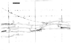
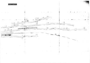
Non renseignéCoupe
Z Origine
Non renseignéAuteur
Non renseignéDate
Non renseignéDocument(s) numérisé(s)
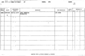
46 document(s)| Vignette | Nom | Type | Poids |
|---|---|---|---|
|
C6229.TIF |
|
162 Ko |
|
C6230.TIF |
|
128 Ko |
|
C6231.TIF |
|
83 Ko |
|
C6232.TIF |
|
66 Ko |
|
C6233.TIF |
|
66 Ko |
|
C6234.TIF |
|
114 Ko |
|
C6235.TIF |
|
193 Ko |
|
C6236.TIF |
|
84 Ko |
|
C6237.TIF |
|
86 Ko |
|
C6238.TIF |
|
74 Ko |
|
C6239.TIF |
|
180 Ko |
|
C6240.TIF |
|
77 Ko |
|
C6241.TIF |
|
176 Ko |
|
C6242.TIF |
|
84 Ko |
|
C6243.TIF |
|
200 Ko |
|
C6244.TIF |
|
80 Ko |
|
C6245.TIF |
|
87 Ko |
|
C6246.TIF |
|
81 Ko |
|
C6247.TIF |
|
175 Ko |
|
C6248.TIF |
|
78 Ko |
|
C6249.TIF |
|
190 Ko |
|
C6250.TIF |
|
81 Ko |
|
C6251.TIF |
|
183 Ko |
|
C6252.TIF |
|
75 Ko |
|
C6253.TIF |
|
200 Ko |
|
C6254.TIF |
|
79 Ko |
|
C6255.TIF |
|
172 Ko |
|
C6256.TIF |
|
85 Ko |
|
C6257.TIF |
|
80 Ko |
|
C6258.TIF |
|
76 Ko |
|
C6259.TIF |
|
55 Ko |
|
C6260.TIF |
|
79 Ko |
|
C6261.TIF |
|
65 Ko |
|
C6262.TIF |
|
75 Ko |
|
C6263.TIF |
|
52 Ko |
|
C6300.TIF |
|
11 Ko |
|
C6301.TIF |
|
112 Ko |
|
C6302.TIF |
|
145 Ko |
|
C6303.TIF |
|
105 Ko |
|
C6304.TIF |
|
14 Ko |
|
C6305.TIF |
|
23 Ko |
|
C6306.TIF |
|
28 Ko |
|
M500782.TIF |
|
28 Ko |
|
M500783.TIF |
|
20 Ko |
|
M500784.TIF |
|
21 Ko |
|
S322669.PDF |
|
1265 Ko |