


Identifiant national de l'ouvrage
BSS002AUYB
Ancien code - avant 2017
08686X4001
Localisation
Département
DROME (26) - SGR/RHACommune
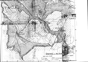
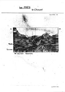
PRES (26255)Nom local
GTNuméro de carte
0868Huitičme
6XRégion naturelle
Non renseignéBassin versant
Non renseignéAdresse ou Lieu-dit
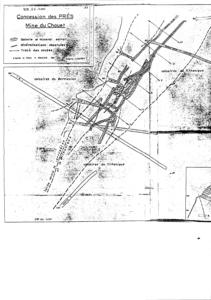
LES-PRES (LE-CHOUET)Coordonnées
| Systčme | X (m) | Y (m) |
|---|---|---|
| Lambert 2 étendu | 856382 | 1954237 |
| Lambert 3 - Sud | 856200 | 254100 |
| Lambert-93 | 903453 | 6385821 |
| Systčme | Latitude | Longitude |
|---|---|---|
| WGS84 | 44.54176371 | 44° 32' 30'' N | 5.56140853 | 5° 33' 41'' E |
Altitude
1050.0 m - Précision EPDDescription technique
Nature
GITE-MINIERProfondeur atteinte
Non renseignéDiamčtre de l'ouvrage
Non renseignéDate fin de travaux
1929-01-01 00:00:00.0Mode d'exécution
TRACAGE.Etat de l'ouvrage
ANCIENNE-EXPLOITATION.Utilisation
Non renseignéObjet de la recherche
Non renseignéObjet de l'exploitation
PLOMB,ZINC.Objet de la reconnaissance
Non renseignéGisement
AMAS.Références
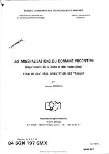
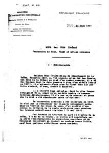
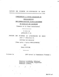
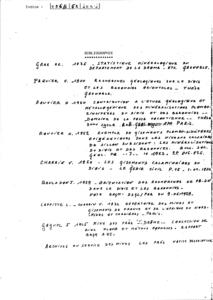
ROUVIER H. (1960) THESE,PARIS - GOGUEL J. (1945) RAP.BRGGM A,66 - MONTHEL J. (1984) RAP.BRGM 84 SGN 197 GMXRéférencé comme point d'eau
 NON
NON
Niveau d'eau mesuré par rapport au sol
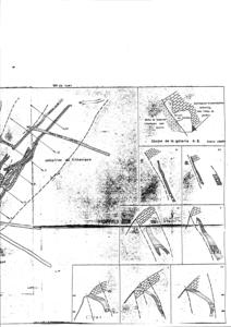
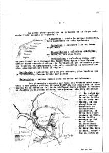
Non renseignéCoupe
Z Origine
Non renseignéAuteur
Non renseignéDate
Non renseignéDocument(s) numérisé(s)
40 document(s)| Vignette | Nom | Type | Poids |
|---|---|---|---|
|
E20617.TIF |
|
65 Ko |
|
E20618.TIF |
|
53 Ko |
|
E20619.TIF |
|
53 Ko |
|
E20620.TIF |
|
269 Ko |
|
E20621.TIF |
|
343 Ko |
|
E20622.TIF |
|
537 Ko |
|
E20623.TIF |
|
1017 Ko |
|
E20624.TIF |
|
191 Ko |
|
E20625.TIF |
|
7 Ko |
|
E20626.TIF |
|
43 Ko |
|
E20627.TIF |
|
108 Ko |
|
E20628.TIF |
|
50 Ko |
|
E20629.TIF |
|
59 Ko |
|
E20630.TIF |
|
20 Ko |
|
E20631.TIF |
|
17 Ko |
|
E20632.TIF |
|
18 Ko |

|
E20633.TIF |
|
48 Ko |
|
E20634.TIF |
|
68 Ko |
|
E20635.TIF |
|
61 Ko |
|
E20636.TIF |
|
63 Ko |
|
E20637.TIF |
|
128 Ko |
|
E20638.TIF |
|
92 Ko |
|
E20639.TIF |
|
96 Ko |
|
E20640.TIF |
|
53 Ko |
|
E20641.TIF |
|
89 Ko |
|
E20642.TIF |
|
22 Ko |
|
E20643.TIF |
|
59 Ko |
|
E20644.TIF |
|
63 Ko |
|
E20645.TIF |
|
62 Ko |
|
E20646.TIF |
|
67 Ko |
|
E20647.TIF |
|
65 Ko |
|
E20648.TIF |
|
60 Ko |
|
E20649.TIF |
|
52 Ko |
|
E20650.TIF |
|
54 Ko |
|
E20651.TIF |
|
64 Ko |
|
E20652.TIF |
|
59 Ko |
|
E20653.TIF |
|
58 Ko |
|
E20654.TIF |
|
60 Ko |
|
E20655.TIF |
|
9 Ko |
|
E20656.TIF |
|
40 Ko |